About QField for QGIS
QField focuses on efficiently getting GIS fieldwork done and exchanging data between the field and the office in a comfortable and user-friendly way. QField has won the prestigious Best of Swiss Apps Award 2022 in the...
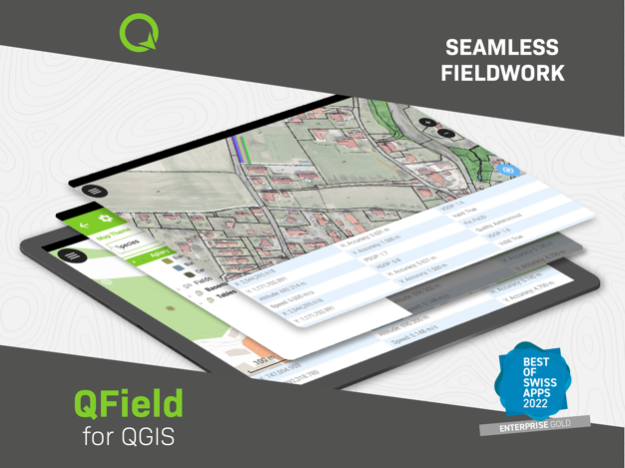
QField focuses on efficiently getting GIS fieldwork done and exchanging data between the field and the office in a comfortable and user-friendly way.
QField has won the prestigious Best of Swiss Apps Award 2022 in the enterprise category and thanks to its native integration with QFieldCloud, your fieldwork will be as efficient as possible.
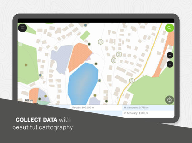
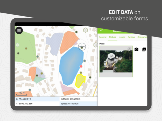
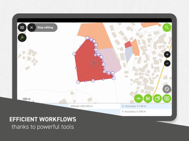
Built on top of the popular QGIS open-source project, QField lets users consume fully configured projects in the field, allowing for customized feature forms, map themes, print layouts, and more, bringing the power of QGIS to your fingertips.
Leveraging open source libraries such as gdal, SQLite and PostGIS, QField reads, displays and allows editing of a wide variety of spatial vector and raster datasets. Users can view and modify datasets wherever they are, whether they have been downloaded onto your device, shared in emails or transferred via USB cable.
The supported formats include:
- QGIS project files (.qgs, .qgz, as well as geopackage-embedded projects);
- SQLite-based geopackage and spatialite databases;
- GeoJSON, KML, GPX, and shapefile vector datasets;
- GeoTIFF, GeoPDF, WEBP, and JPEG2000 raster datasets.
Looking for missing capabilities? OPENGIS.ch is happy to help with the implementation of new features. Contact us at https://www.opengis.ch/contact/
Permissions
---
QField can use location permission to draw a marker overlaying device location on top of spatial projects and datasets. QField can also display and use location details such as latitude, longitude, elevation, and accuracy while entering data.
Notes
---
For bug reports, please file an issue at https://qfield.org/issues
Mar 25, 2024
Version 3.2.2
- Bug fixes all around.
Previous Versions
Here you can find the changelog of QField for QGIS since it was posted on our website on 2023-07-07 12:47:10.
The latest version is 3.2.2 and it was updated on 2024-04-19 19:50:09. See below the changes in each version.
QField for QGIS version 3.2.2
Updated At: 2024-03-25
Changes: Mar 25, 2024
Version 3.2.2
- Bug fixes all around.
QField for QGIS version 3.2.0
Updated At: 2024-03-07
Changes: Mar 7, 2024
Version 3.2.0
Features
- Project-defined tracking sessions activated on project load
- Background push and synchronization for cloud projects
- Automatically push pending changes to the cloud on a regular interval
- New undo/redo functionality allowing you to reverse undesired digitizing and feature editing
- Title and copyright decoration overlay on top of the map canvas
Improvements
- Better progress feedback when downloading and synchronizing cloud projects
- Visual indicators of ‘newer’ cloud project available on the server in QField
- Relationship’s children can now be created prior to saving their parent feature
- Insure positioning precise view (i.e. stake-out) works on compass-less devices
- User interface polishing, including a brand new main menu layout
- Support for gpsd-served NMEA streams over TCP/UDP
- Updated several underlying libraries, including QGIS (v3.36) and Qt (v6.6.2)
QField for QGIS version 3.1.8
Updated At: 2024-01-17
Changes: Jan 17, 2024
Version 3.1.8
Tons of bug fixes and stability improvements.
QField for QGIS version 3.1.0
Updated At: 2023-12-15
Changes: Dec 15, 2023
Version 3.1.0
Features:
- QField can now snap to common angles when digitizing lines and polygons
- Expression-driven locking of geometry per feature
- The QML camera now adds direction metadata alongside geographical information
- The QML camera now features a grid overlay
- Vertex editor has again a new undo mechanism and capability to select a vertex by finger tapping on the screen
- @positioning_orientation variable available when running on devices equipped with a compass
- Functionality to allow for non-cloud projects to be updated through a ZIP file containing refreshed and/or new datasets and project file
Improvements:
- Improvement on the rendering of the coordinate cursor and digitizing rubber bands to insure visibility against both light and dark backgrounds
- Screen lock improvements, including disabling interactions with the back button
- Better handling of camera, microphone, and location permissions
- Significant stability improvements
QField for QGIS version 3.0.7
Updated At: 2023-11-19
Changes: Nov 19, 2023
Version 3.0.7
Tons of bug fixes.
QField for QGIS version 3.0.5
Updated At: 2023-10-30
Changes: Oct 30, 2023
Version 3.0.5
- Fix line and polygon highlight on rotated map
- Fix display of feature form's HTML
- Fix corrupted Exif image orientation metadata when maximum image size setting is enabled
QField for QGIS version 3.0.3
Updated At: 2023-10-25
Changes: Oct 25, 2023
Version 3.0.3
General features:
- Near-Field Communication (NFC) text tag reading support
- The welcome screen’s recent projects list is now equipped with a map canvas preview
- New active layer feature search functionality in the top search bar
- New map canvas rendering quality setting to unlocked faster rendering speeds and lower memory usage at the cost of a slightly rendering quality reduction
- A list of feature(s) under which a long press has occurred is now appended to the map canvas menu with action shortcuts
- Relationship-related editor widgets now allows for zooming onto the child/parent within the feature form
- Layer credits are now displayed within the layer properties panel when available in opened projects
- Imperial and nautical scale bar support
- Feature form text widget support
Tracking features:
- New erroneous position safeguard defined as a maximum distance threshold
- Resumption of tracking across sessions
Digitizing features:
- New snapping button which allows users to toggle snapping on/off while digitizing
- New legend snapping badges when project is set up to advanced snapping mode
- Digitizing of geometry vertices through volume keys
- Brand new geometry editor’s eraser tool allowing users to remove parts of a geometry by drawing areas of deletion
QField for QGIS version 2.8.3
Updated At: 2023-06-25
Changes: Jun 25, 2023
Version 2.8.3
Improvements:
- Support opening .mbtiles standalone datasets
Bug fixes:
- Fix a narrow scenario when checkbox editor widget fails to toggle to False
- Fix compass direction not pointing towards north for a number of CRSes
- Fix copying of bookmark details into the clipboard
Disclaimer
Official App Store Link
We do not host QField for QGIS on our servers. We did not scan it for viruses, adware, spyware or other type of malware. This app is hosted by Apple and passed their terms and conditions to be listed there. We recommend caution when installing it.
The App Store link for QField for QGIS is provided to you by apps112.com without any warranties, representations or guarantees of any kind, so access it at your own risk.
If you have questions regarding this particular app contact the publisher directly. For questions about the functionalities of apps112.com contact us.